(Press release from DOST-PCIEERD) On May 31, 2024, the Department of Science and Technology (DOST) and Mapua University launched a 24/7 localized weather information and impact monitoring system to help the Philippines prepare for the coming La Niña.
Developed by Mapúa University School of Civil, Environmental and Geological Engineering, led by Dr. Francis Aldrine Uy, and supported by DOST’s Philippine Council for Industry, Energy, and Emerging Technology Research and Development (DOST-PCIEERD), the Localized Weather, Environment, and Hydromet Monitoring System (Project WEHLO) will augment the country’s La Niña disaster risk reduction and management operations.
“We believe that scientific advancements are not just about immediate responses to natural hazards and consequent disasters; they are about creating long-term solutions that reduce risks and promote sustainable development,” according to DOST Secretary Dr. Renato U. Solidum, Jr. “As we face increasing disaster risks, we must move beyond traditional approaches and embrace innovations that provide solutions and open opportunities for a better tomorrow.”
Funded by DOST-PCIEERD
Project WEHLO is among the funded technologies of the DOST-PCIEERD under the Funding Assistance for Spin-off and Translation of Research in Advancing Commercialization (FASTRAC) Program. The funding provided amounts to Php 15 million.
“Innovative DRRM technologies like WEHLO play a crucial role in our disaster preparedness,” said DOST-PCIEERD Executive Director Dr. Enrico Paringit. “As La Niña approaches, precise weather information really empowers municipalities and enhances disaster management.”
It is often said that the Philippines experiences an average of 20 typhoons every year. According to the DOST-Philippine Atmospheric, Geophysical and Astronomical Services Administration (DOST-PAGASA), La Niña may occur during the second semester of this year as El Niño weakens.
Last year, Project WEHLO and Mapua University inked a memorandum of agreement for weather data sharing with DOST-PAGASA. Project WEHLO has already established partnerships with the local government units of Infanta-General Nakar, Quezon, and Pantabangan-Angat, Bulacan. The technology helps municipalities gather reliable and accurate real-time data with continuous transmission in times of disaster when bad weather conditions, signal interruptions, and power outages occur.
In addition, Project WEHLO is designed to monitor and provide data on watersheds, which can be useful for dam operators and agriculture for farm management.
Adhering to international standards
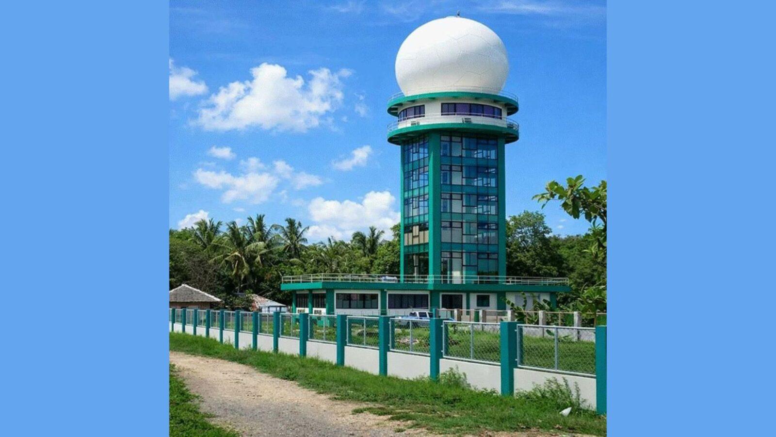
Unlike other existing weather monitoring systems in the country, WEHLO ensures that its system adheres to the international standard set by the World Meteorological Organization (WMO). Project WEHLO also developed an improved version of the Automated Real-Time Monitoring System (ARMS) sensor with DOST-PAGASA.
“One of the advantages of this technology is that we can modify the system based on the users’ needs which means, we can manually calibrate the system and provide localized readings including rainfall, temperature, humidity, pressure, soil moisture, wind speed, wind direction, flow velocity, and water level,” said Uy, CEO of USHER Technology Inc.
Users can access data through their web portal and mobile application with an alert warning feature. (Editor’s note: As of this writing, the Project WEHLO website indicates that it will “launch soon.”)—MF